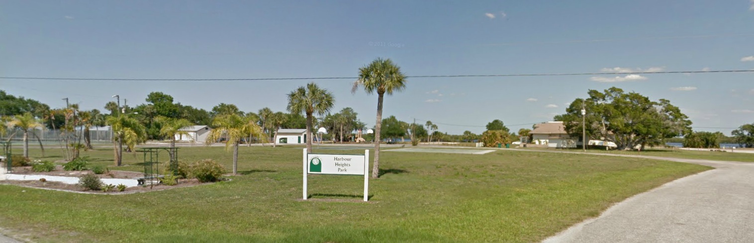
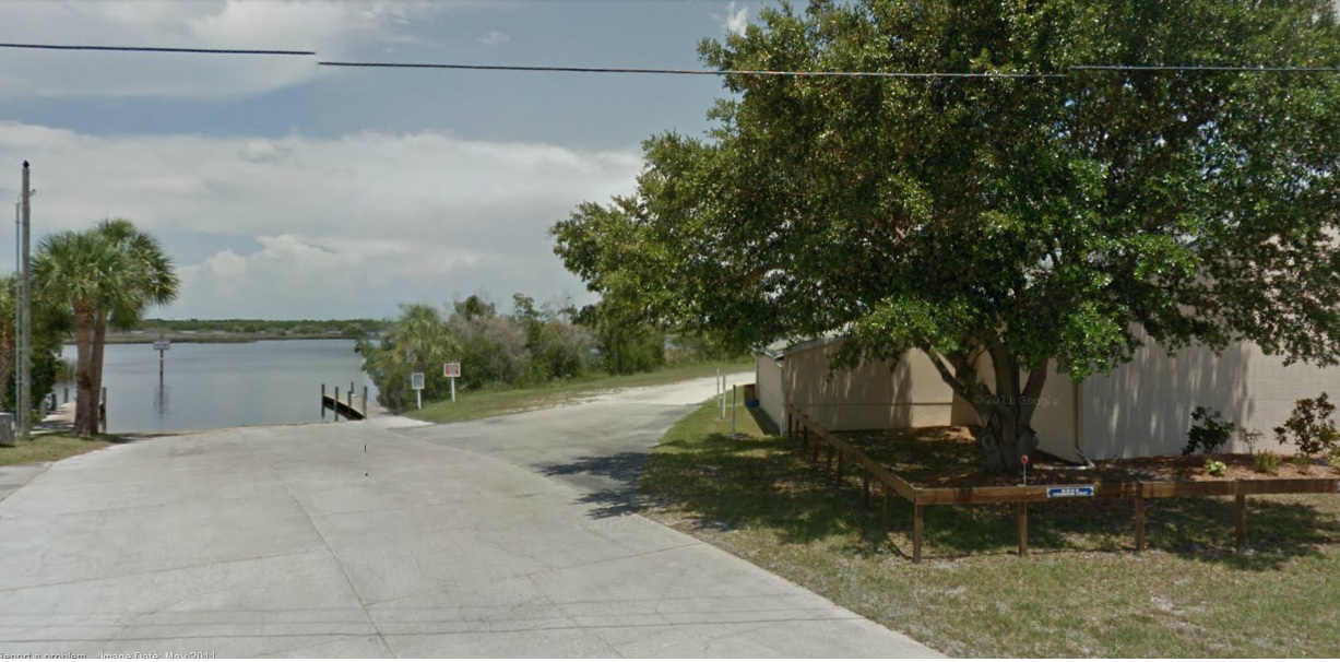
Harbor heights Ramp.
![]()
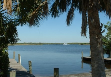
This a Salt / brackish water ramp. good for small to medium size boats, a
great place for windy days.
It is a double wide ramp easy for 2 boats at a time to use,
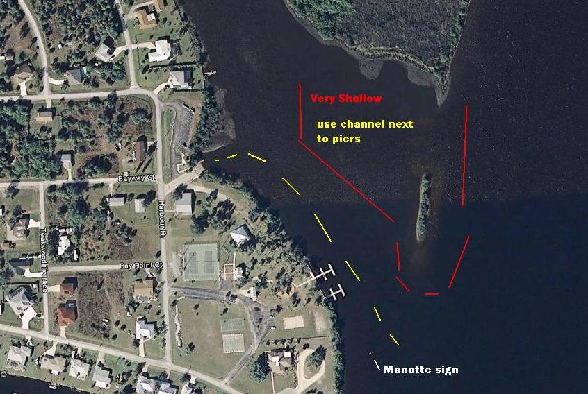
When the dredging is finished there is a chance it will have deep water access,
for now 2 feet on low tide maybe 4 feet of water on a high tide.
This is a nice place to launch as the ramp is not steep at all, and lots of room to turn around,
This is a pay to park ramp .
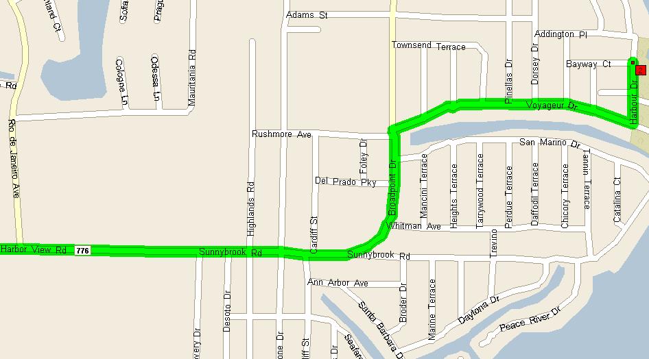
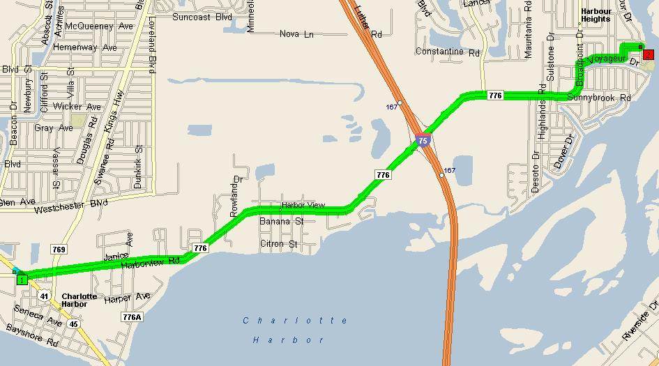
Summary: 5.7 miles (12 minutes)
| Time | Mile | Instruction | For | Toward |
| 9:00 AM | 0.0 | Depart Fishin Franks | ||
| 9:00 AM | 0.1 | Road name changes to CR-776 [Harborview Rd] | 3.5 mi | |
| 9:06 AM | 3.6 | Keep STRAIGHT onto CR-776 [Harbor View Rd] | 0.9 mi | |
| 9:08 AM | 4.5 | Road name changes to Sunnybrook Rd | 0.3 mi | |
| 9:09 AM | 4.8 | Bear LEFT (East) onto Broadpoint Dr | 0.3 mi | |
| 9:10 AM | 5.1 | Turn RIGHT (East) onto Voyageur Dr | 0.5 mi | |
| 9:12 AM | 5.6 | Turn LEFT (North) onto Harbour Dr | 0.1 mi | |
| 9:12 AM | 5.7 | Arrive
Harbour Heights Ramp |
SUMMARY
Driving distance: 5.7 miles
Trip duration: 12 minutes
Driving time: 12 minutes
Cost: $0.61
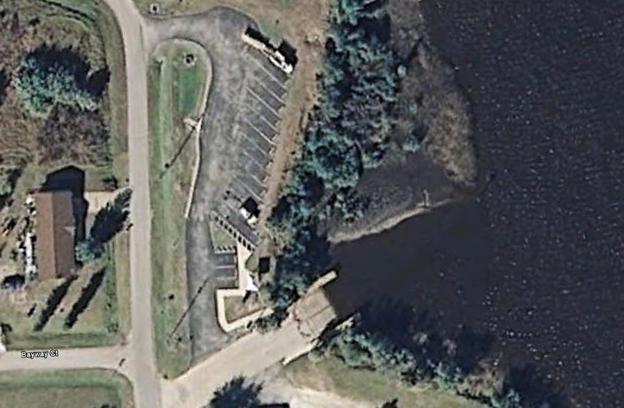
The map under the next one show a close up of how to get to the ramp.
When you entre Harbour Heights, There are trees dividing the traffic, when
the divider end turn right.
When you see the park turn right.